Sensen Nature Reserve
שמורת סנסן
About
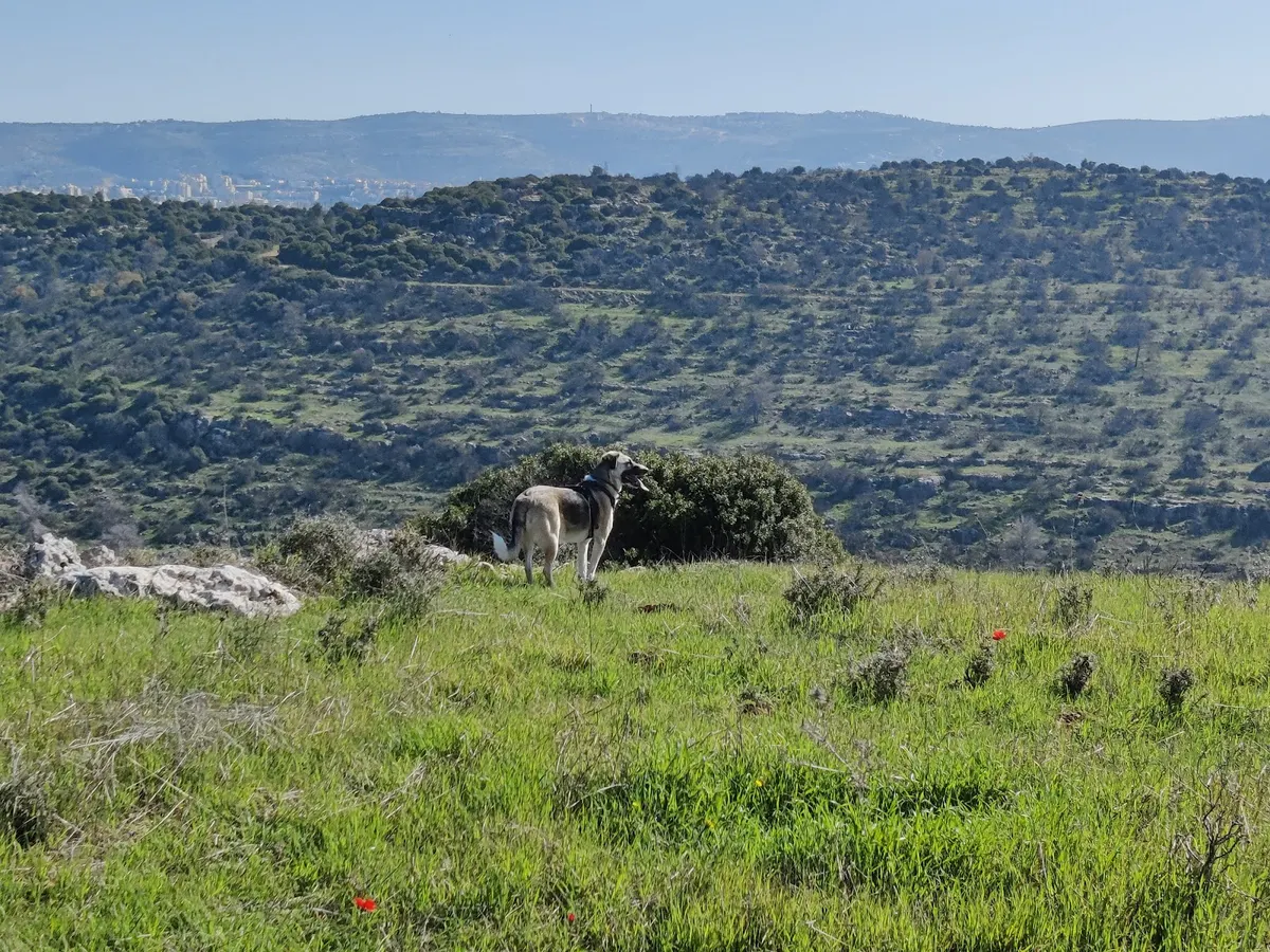
All the information about the Sansen Nature Reserve The Sansen Nature Reserve spans an area of 14,294 dunams, between the community of Tzur Hadassah in the east, the moshav Aviezer in the west, Route 367 in the south, and Route 375 in the north. In the reserve, there are footpaths, breathtaking viewpoint overlooks, bicycle trails, and seasonal blooms of various wildflowers, including the large tulip (halmonit gadol), autumn squill (Ben-Ha'tsav setavi), winter squill (Setvoniya Hayora), winter crocus, cyclamens, norka plants, and many other flowers alongside natural woodland trees, among them the natural oak, the toulah oak, and the Pistacia palaestina (Eretz Yisrael tree). Animals also frequent the area, including deer, foxes, wild boars, and jackals. Hiking routes in the Sansen Nature Reserve The reserve offers several routes that reveal combat heritage, landscapes, blooms, ancient ruins, and ancient agriculture. Trail marking 9434 (red) will take you to Givat HaKrav (the Battle Hill), where you will also see the Lamed-He (L"ה) memorial and the monument commemorating the 35 Palmach and H"ish fighters who died here while coming to help the besieged communities of Gush Etzion. Hiking the trail marked 9416 (red) will take you to Nahal Sansen (Sansen Stream) and the moshav Matta. Another red trail—9413, toward Wadi Fukhין—and a blue trail—9457—from the old Patrol Road, via the streambed of Nahal Atziona, continuing until almost the moshav Aviezer. Key sites in the reserve: Mount Sansen Climbing to an elevation of 733 m above sea level will bring you to the summit of the mountain, also known as Jebel Sanasin. There is also a beautiful grove at the top of the mountain. From here you can enjoy a viewpoint overlooking the entire area—from Har Hevron, through the Arab villages of Tzurifi and Jaba', Betar Illit, the communities of the Gush Etzion bloc, Wadi Fukhín, the orchards of Kfar Etzion, the Shephelah, and the coastal plain. If you look down, you will see the old Patrol Road. Nahal Sansen The beginning of Nahal Sansen is west of the community of Tzur Hadassah. The stream runs for 14 km through the Jerusalem Hills and ends where it joins Nahal Ha'Elah. The scenery in the stream's disappointment (the stony channel) is rocky, but if you look up over the streambed, you will see different rock layers—created by the stream itself as it carved its course there. Horvat Sansen To reach the foot of Horvat Sansen, you must continue on the Black Road north of Mount Sansen, bypass another peak, and finally climb up to an elevation of 702 m. Here there are remains of a Byzantine settlement, a bathhouse, and a columbarium. Givat HaKrav (Battle Hill) In January 1948, 35 Palmach fighters were sent from the Har-Tov Colony toward the four isolated communities of the Gush Etzion bloc—Kfar Etzion, Revadim, Massuot, and Ein Tzurim. They set out on foot for the mission, which ended in a fierce battle and the fall of all the fighters. The place where they fell is known as Givat HaKrav, at an elevation of 573 m, in the south-western slopes of the Jerusalem Hills, on a spur of the Sansen Ridge. Where do the tulips bloom most? North of Horvat Sansen, at N.C. 206621/622736. After passing the village gate, continue on foot along the Black trail markings until you reach the intersection with the Green trail markings—about a 4 km walk. From there, you will enter the channel of Nahal Sansen, walking west until you encounter them scattered across the area, not always visible. Usually they are about 150 meters below the Black trail, on the goat paths located on the northern slope of the stream or on the southern side of the stream, near the rock steps—above the first line of oaks over the wadi. Useful information Some parts of the reserve are within the IDF firing range, which requires prior coordination on weekdays. Entry to the Black trail is from within the community of Tzur Hadassah. To pass through the entrance gate, you must contact their call center at phone 050-6558466 or 6412*. Note that there are several gates to the reserve; at each one, the number of the gate to be provided to the call center appears on site, so they can open the appropriate gate for you. For example—at the entrance from Rechasim Street (Rakhasi'im), the gate is number 1. Another option for entering for a hike on the Sansen Ridge Enter Yehuda HaRim Street in Tzur Hadassah (east entrance), and continue driving following the signs to the Horse Farm, located near the Blue trail. If the gate in the fence is closed, contact the Horse Farm to open it at 02-5791355.
Tags
More activities in Jérusalem
Need help planning your activities?
Our French-speaking team helps you plan your stay in Israel, with personal advice, reservations and transfers.