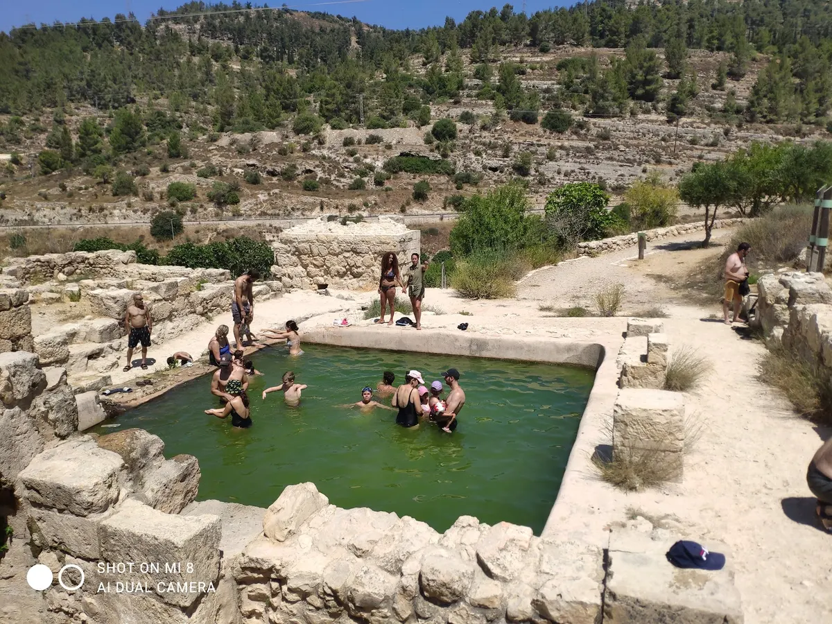
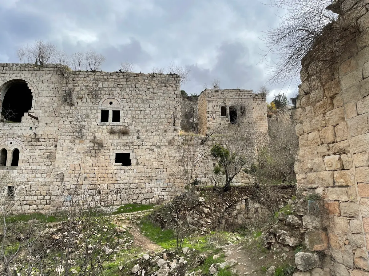
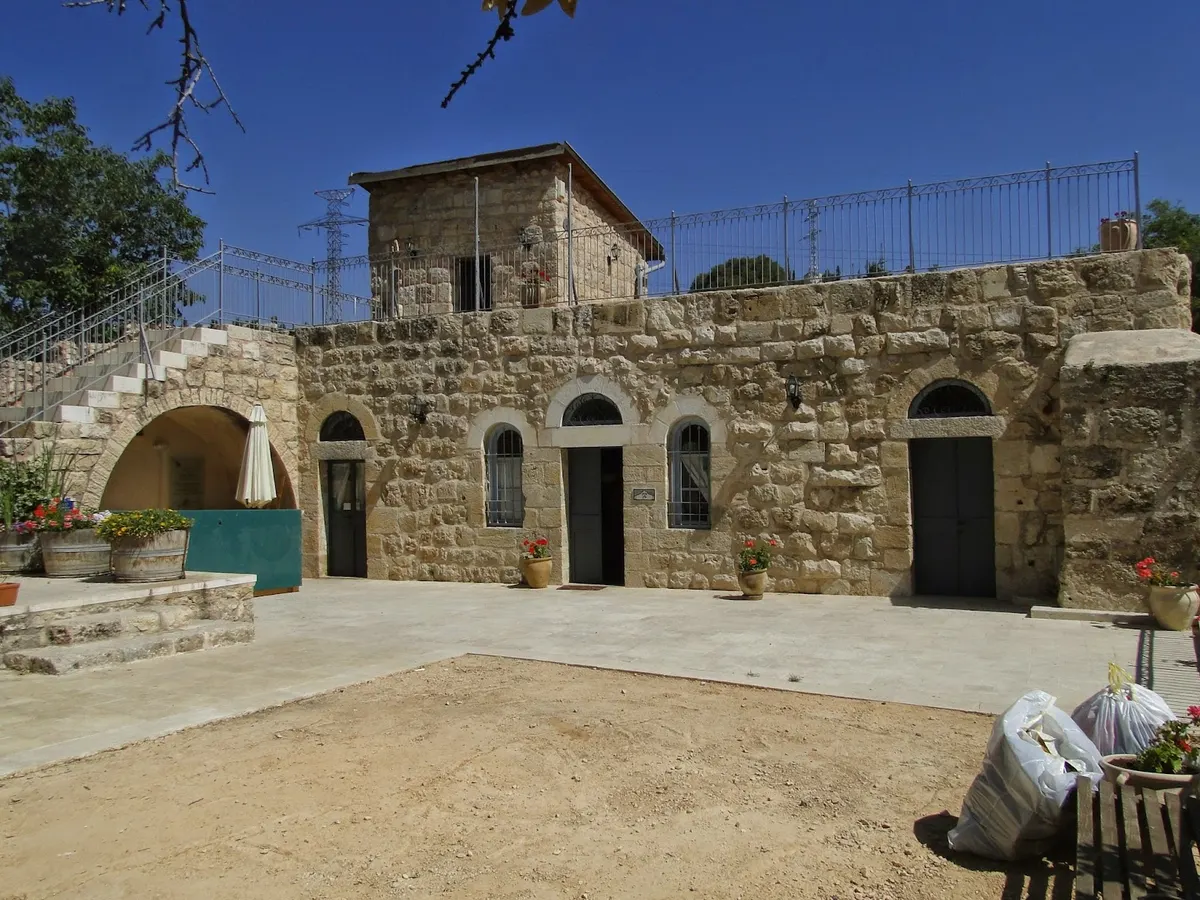
All the information about Lifta – every stone has its own story Anyone who rode a horse and a cart to Jerusalem a hundred years ago and looked northward toward the green and deep valley at the entrance to the city would have noticed an Arab village. Perhaps they might even have had the chance to see a fellah working the terraces. Today, travelers to Jerusalem look to either side: on one side, the city cemetery; on the other, a green valley with abandoned, crumbling stone houses. In some houses near Highway 1, residents still live. These stone houses belong to the abandoned Arab village of Lifta, considered one of the most beautiful places for a day trip in the Jerusalem area. The tour offers an exceptional historical and architectural experience, giving a sense of how people lived and farmed in the past. The village was located between the main road to Jerusalem (Highway 1 and Jaffa Road) and the secondary road climbing up to the city (Begin Road, today). To start the tour, begin with a short descent into Lifta's spring. From the parking area (directions appear later), you go down a steep path with a beautiful view of the historic village and the spring, named after the biblical settlement "May Niftóaḥ" (Waters of Neph-toah / Niftah). This settlement is mentioned as a boundary between the land holdings of the tribe of Judah and Benjamin: "and its border went from the south side, at the edge of Kiriath Jearim, and the border went westward and extended to the spring of the waters of Niftóaḥ" (Joshua 18:15). After taking in the spring, which in the past was the village's only water source and later became a mikveh for the ultra-Orthodox from the nearby neighborhoods, we continue along the blue trail marker among fig trees (at the end of summer you can pick figs and enjoy their special taste). We walk along the village's main street, where in the past carts with horses carried goods. Today part of it is paved and easy to walk on. While strolling in quiet, pastoral surroundings, you can look around with wonder at the stone houses. Warning: The Israel Land Authority has fenced buildings intended for preservation in the Lifta village area. The buildings are old and run-down, and entering them is dangerous. If any buildings that appear in the route presented here have been fenced off, entry to them is strictly prohibited! Step into history during the Ottoman period, in the early days of the Muslim village. Before that, there had been a Jewish biblical village here that earned its livelihood from agriculture and selling water to Jerusalem residents. The inhabitants lived in caves cut into the stone; you can barely make them out along the sides of the slopes. Not long afterward, around 1596, the villagers left the caves and built newer, denser homes in the form of a wall with towers inside it. This building style was meant to protect both the people living in the houses and those traveling along the roads between them, and it helped in wars that took place in the area, such as the fellahs' war against the Egyptian conqueror in the 19th century. After this war, the village developed outward from the center. We will reach the center later, where the trail marker turns left in a sharp curve (a "parasa"/sweep) and a narrow dirt path continues straight between the houses. In the center, the mosque was built, and later it was joined by a guesthouse—the village han (caravanserai). Today you can identify it in a large square building surrounded by a high wall, divided into two sections, one of which is a partially paved courtyard with a water well. Along the bend in the trail that turns left, around the mosque, one of the four olive presses was built. This is the largest and most modern of them, and it can be visited, but it is important to be careful due to a risk of collapse. Entry to the other olive presses requires crawling and is not recommended. As the village expanded and the center grew, the number of residents increased as well: around the 1860s, 300–400 people lived there. Population growth brought new buildings. On the left side of the valley, near Highway 1, modern houses were built in new shapes—without a wall or tower and less densely—because the situation was safer. Some of these structures still stand on the other side of the valley. They are built rectangularly, with two floors and external staircases leading to the upper floor. The upper floor was used for living, while the lower floor was for the sheep and family animals. Some of the new houses were even built on these older foundations. You can notice this by the difference in the stones—more carefully cut "blanks" than in earlier sections. You can also see that each house was built on a large plot of land, unlike in the center, and alongside it there was a structure used as a storage shed for agricultural produce, usually shared by several families together. These houses belonged to the village's wealthier residents, who raised sheep and goats as well as worked the olive, grapevine, and fig terraces. Some of these houses—still standing almost intact—belonged to the Muktar family of the village. You can reach them via a slight descent from the trail marker that turns left, walking through dense vegetation. A careful climb onto the roof of the upper floor will reveal a beautiful view of the entire village and the terrace farming. Pay special attention to the window shapes of these houses: they are not simple, square windows like those in the village center, but rather arched, indicating the structure's relative wealth. Some of these houses were paved with decorated tiles that have been partially preserved—for example, in the large structure on the left above the spring. In a photo showing a cross-section inside a typical Lifta house, from left to right you can see a small decorated oven, and above it a ventilation window. A door, which later was sealed and turned into a large storage compartment, and beside it a smaller storage compartment. As you wander along the path, you will notice niches and corridors between the houses in the village center. These alleys served as the courtyards of the houses, where children ran around and played. In the center of the village and at road junctions, you can see flat areas of large stones that served as benches and created places for conversation and social and cultural gatherings. We will return to the path in the valley and continue walking back in time. At the beginning of the 20th century, the village expanded up the hill—"Lifta Elyit" (Upper Lifta)—and became part of the urban continuum of Jerusalem. Today this area is absorbed into Ramot, Givat Shaul, and other neighborhoods in the valley of Jerusalem. We jump ahead with a small skip in history to the British Mandate period; later along the trail we move on to the British Mandate and the railway line from Jerusalem to Cairo. Parts of it were looted and used as support beams for doors and balconies of houses that were reinforced with cement. You can still see the tracks clearly today. We continue down the trail toward Jerusalem Park and the Valley of the Cedar Trees, turning our gaze back once more to look at picturesque Lifta receding away from us. We leave the village—just as the Arabs abandoned it at the outbreak of the War of Independence in 1947, at the instruction of the Supreme Arab Committee, in order to turn it into a base for the Nagehda organization (a national Arab youth-military organization that operated after the end of World War II). Lifta was finally taken over by the IDF at the end of the War of Independence. In February 1948 the village was already empty, and the young State of Israel transferred new immigrants to it—who had just arrived—due to a shortage of available temporary housing. Later, most of these residents moved to nicer, modern homes in New Jerusalem. Arriving in today's Lifta: today, a few homeless people also live in Lifta, having entered and taken over the abandoned buildings. To combat this phenomenon, the Jerusalem municipality demolished the roofs of the structures (see photo). The holes hastened the collapse of the old houses, but most are still preserved fairly well. If we continue along the trail, we reach the end of the route and the Cedar Park; from there we will have to retrace our steps back to the parking lot via the steep, long climb. One of the Jerusalem municipality's plans is to turn Lifta into an exclusive residential area while preserving the village landscape and architecture. Meanwhile, until the final decision is made regarding preservation of the site and building plans, the area remains stunning in its beauty—one of the last Arab villages preserved as it once was.
נקודות עניין היסטוריה וארכיאולוגיה בירושליםנקודות עניין היסטוריה וארכיאולוגיהנקודות עניין: טבענקודות עניין: מעיין